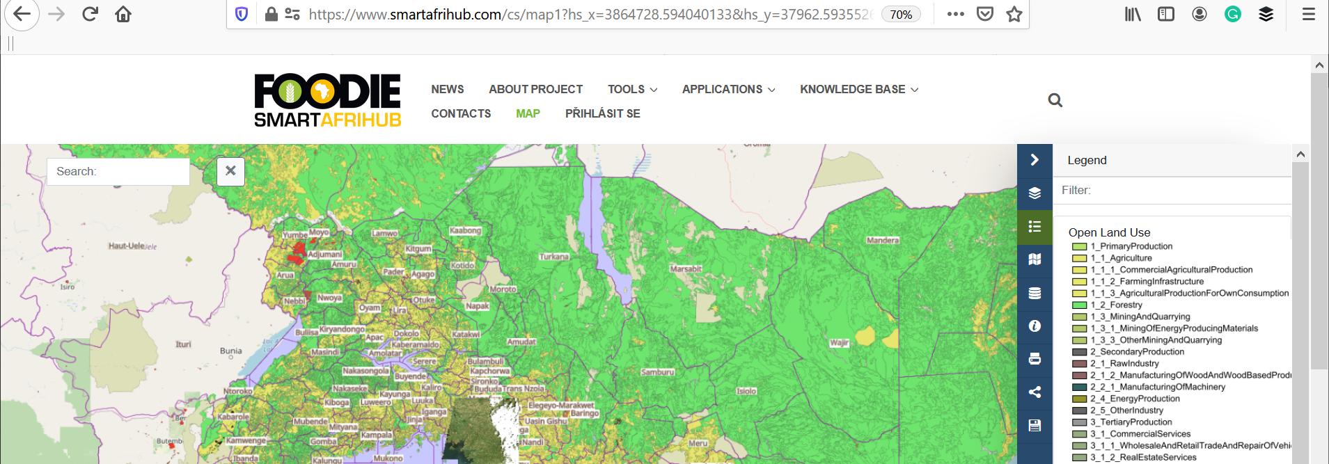
As we promised already from beginning Maps became finally integrated part of our SmartAfriHub. What you can see is a powerful Map client, based on HSLayers NG technology. But this is the only a visible part of all solution. Together with two other components Catalogue Open Micka and Backend publishing and data management system Layman it together forms a very powerful system, which will allow you not only visualise "Maps", but also will give you possibilities to store and publish your own data, use external services like WMS, prepare different thematic map composition and store this Map composition and also share this Map composition trough social media. So you have now in your hand's powerful instrument, which can help you share and manage data. During next days, we will prepare for your number of educational materials, how to work with this Map system and we plan also the large webinar, where all principles will be explained to you.
Currently, we have only limited sets of data on our Hub, but we are now discussing, which data could be useful for African Agriculture community and how to discover new data resources.
See
https://www.smartafrihub.com/cs/news/-/blogs/massive-agriculture-data-collection-
https://www.smartafrihub.com/cs/news/-/blogs/massive-agriculture-data-collection-ii
If you would like cooperate with us on such discussion, join our Skype discussion group https://join.skype.com/UElkycKcHnuD